

What’s New in Intelligent Vision
Updates and new releases at Unleash live
Enterprise network & security
Set-up & Configuration
Media Capture & Management
Analyze & Assess
Insights & Alerts

ANALYZE & ASSESS
Search by metadata in Atlas
Managing hundreds or thousands of assets can be a complex task, especially when it comes to inspection planning or reviewing assets with specific attributes.
With Unleash live’s latest update, users can now search Atlas layers by metadata attributes. This allows for rapid pinpointing of assets based on specific properties or statuses. By easily panning and zooming to the precise area of interest, teams can streamline inspection planning and asset review processes, boosting overall efficiency and accuracy.

SET-UP & CONFIGURATION
Improvements to Mission Planning
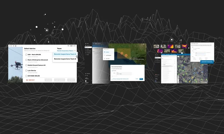
Exciting updates have arrived for the utilities sector! Users can now assign asset inspection missions directly from Fusion Atlas, Unleash live’s GIS platform, to specific teams or individual pilots. This streamlined process allows for saved mission flight paths to be easily reassigned for regular inspections with just a click, simplifying workflows and removing the need for external communication when delegating tasks.
In addition to automated missions, users can now opt for manual flight operations. Once a job is assigned, pilots can manually fly missions based on company requirements, offering flexibility for organizations that prefer manual controls while still leveraging Unleash live’s mission planning and task management features.

ANALYZE & ASSESS
Vessel & vehicle overheight
Unleash live introduces two AI apps designed to enhance safety and prevent accidents in restricted height corridors. These solutions detect overheight vehicles and vessels in specific zones, such as tunnels and low-clearance bridges, using camera calibration for precise height and distance measurement. Operators can customize thresholds for acceptable heights, ensuring accurate reporting and timely alerts. These apps provide real-time monitoring to prevent costly accidents and damage to critical infrastructure.

MEDIA CAPTURE & MANAGEMENT
Obstacle avoidance alerts in Autofly
Enhance flight safety with Unleash live’s Autofly obstacle avoidance alerts, providing audio and visual cues for nearby objects like vegetation, power lines and birds. Supporting both vision and infrared sensing, Autofly features a visual overlay indicating object direction and distance, while audio cues allow uninterrupted focus on flights and missions. Available for both manual and automated flights, the system offers easy controller actions to pause missions, switch to manual control, or land at home or the current position.
Explore past releases below

2024 Release #3
Streaming and AI Processing Scheduling
Enhanced smart corridor generation using layers in Atlas
Autofly updates
Watercraft Detection AI App
Integration with Siemens’ Senseye Predictive Maintenance

2024 Release #1
Camera Scene Mapping
Skydio integration
Improvements to Atlas
New AI Apps to ensure safety
Grafana integration
2023 Release #9
Teams support for Unleash.Autofly
Fusion Atlas Layer Organization
Auto-aggregation of images via Media Drive

2023 Release #8
Bulk transfer 10K+ media files with a click of a button
AI Configuration: Perspective Zones Calibration
New AI app: Staff Detection
Dashboard integration within Unleash.Cloud accounts

2023 Release #7
Fully Automated Missions with Drone in a Box Integration
Mission Planner in Atlas
Updates to Autofly Software
AI Configuration
Generate models of your assets

2024 Release #2
Jobs and task management
Survey Missions
Support for wide angle view and 4K streaming
AI Apps for the Resources and Mining Industry
-
2023 Release #5
- Smart annotations
- Automated missions from Geospatial data
- API for Flight Management Systems
- Download captured media via API
- Teams and Permissions
2023 Release #4
- Access live feeds from all your devices (drone, CCTV, etc) in Fusion Atlas
- Unleash Live partners with AstraUTM for enhanced drone management capabilities
- Compare geographical layers side by side
- Enhance your image viewing: Robust viewer with full metadata and tag support
2023 Release #3
- Syncing Orthomap and KML layers
- Support for DJI M3 and M30
- Optimized flight planning with JSON and KML imports
2023 Release #2
- Autofly marker drop on Atlas Fusion
- Annotation summary and filter
- Panoramic image viewer
2023 Release #1
- Side by side image comparison slider
- Rapid organization of power lines inspection images by asset geolocation
- SafetyCulture’s iAuditor Inspections integration

Ready to get started?
See how Unleash live can help you automate workflows and reduce costs