Unleash live is a platform for ingesting all connected cameras and applying real time visual analytics to provide actionable business insights.
Unleash live is a platform for ingesting all connected cameras and applying real time visual analytics to provide actionable business insights.
Are you part of an enterprise UAV program or a UAV operator? Unleash live enables you to extract gold from your drone work with rapid data capture, visual A.I. analysis, and sharing.
Connecting a camera takes a matter of seconds. The platform is agnostic to the type of camera connected as they are all referred to as a device. Whether it be fixed or mobile IP based, an Android or iPhone, robot or a UAV.
In many cases, the complete solution for our customers is a combination of all of these devices, all playing a role in data capture.
Sign up to our newsletter to stay up to date with the latest industry applications of Unleash live
Connected cameras can take advantage of the following platform capabilities:
- Simultaneous viewing of multiple raw live streams
- Live thermal imagery streaming
- Geo-referenced live video feeds on our Fusion Atlas
- Live A.I. analytics with custom A.I. models
- A.I. post-processing of uploaded images and video files
- Storage of all video and image files in a secure searchable library
However, UAVs uniquely enable an extended layer of functionally on the platform and flown with precision, can provide detailed insights from an aerial vantage point.
Whether you are a professional pilot working as part of a UAV program in your organization, or a UAV service provider, Unleash live has a subscription plan that uniquely combines the following workflows :
- Reducing the time it takes to upload footage
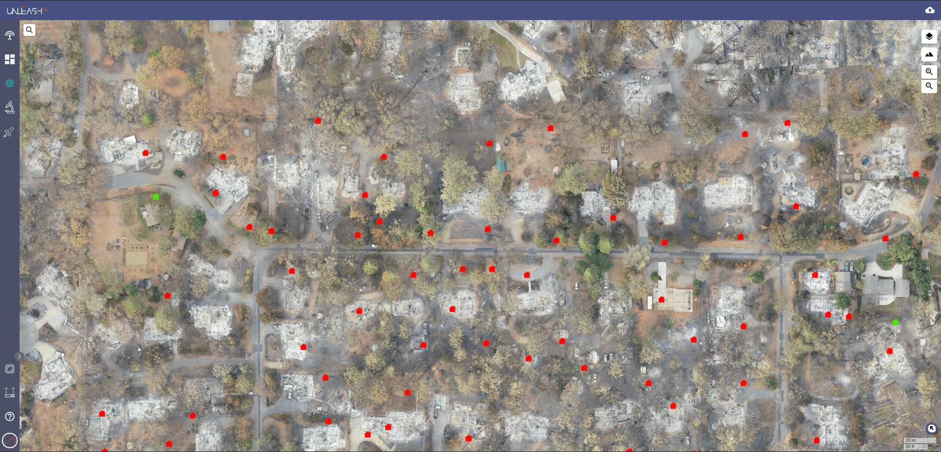
- Create 2D orthomaps, 3D and VR models as well as Point clouds to accurately measure and visualize a space at a fraction of the cost to alternatives
- Multiple orthomap layers for time series comparison and metadata (kml, kmz, csv, geojson, txt) layers
- Annotate visual data to mark up item of interest (coming soon)
- Apply A.I intelligence to gain greater insight and increase productivity by focusing only on the items of interest
- Collaboration between multiple parties to inspect and make decisions fast.
Get started now with a free trial
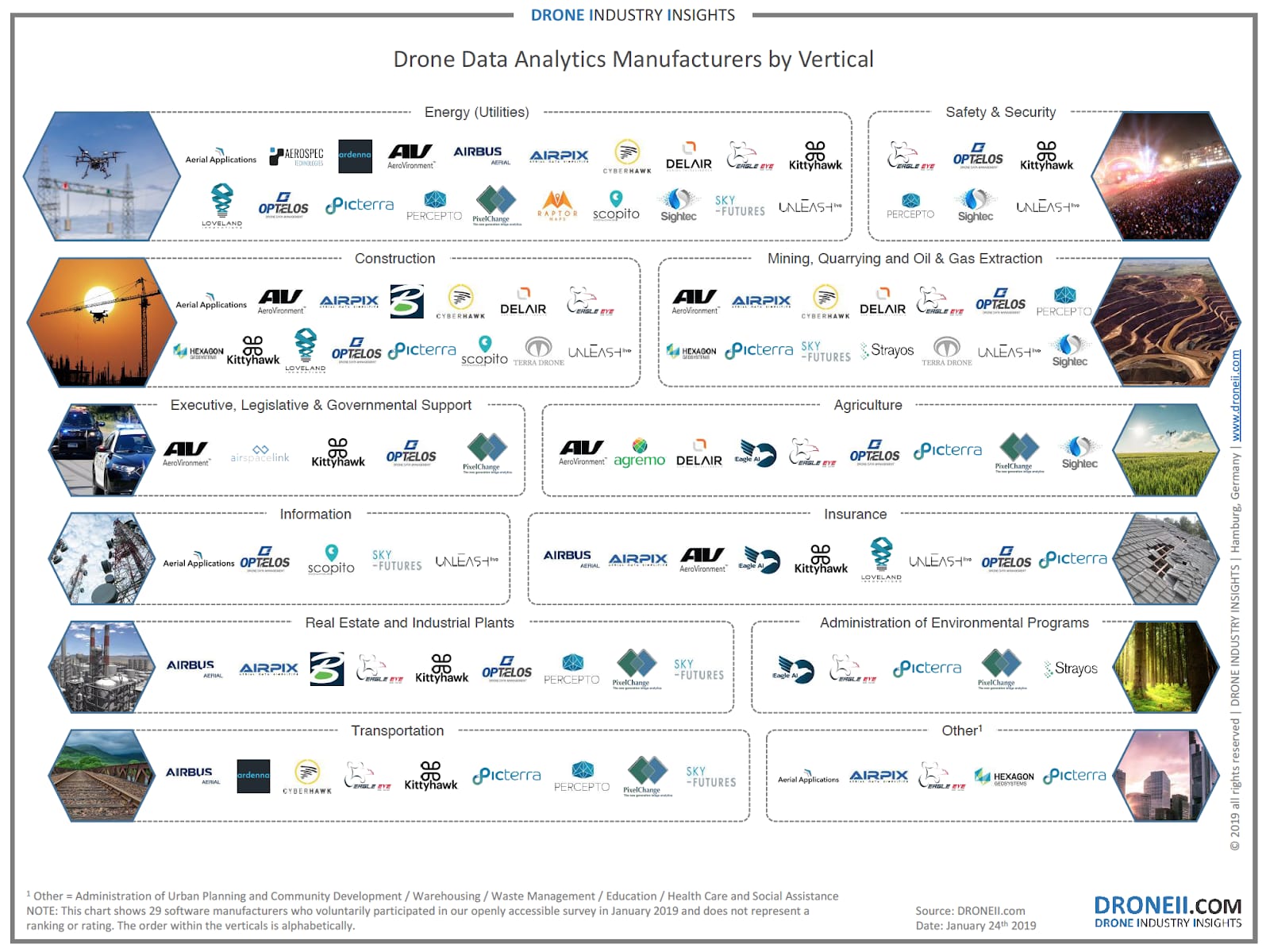
The industry applications are growing at exponential rates. More and more organizations in industries such as Construction, Energy, Safety & Security, Mining and more are looking to reduce their costs, increase productivity and improve reliability by deploying a UAV program. UAV programs can be both in house with trained pilots within a workforce, or acquired as an outsourced service.
Both instances result in vast amounts of data and complicated workflows where multiple parties need access to footage to make decisions.
An Unleash live account enables UAVs to work with rapid data capture, analysis, and sharing.
Unleash live natively support DJI Drones, however, custom requirements can also be met.
Get Started with Unleash live
Visit unleashlive.com to start your free trial or book a time with one of our specialist team members to learn how your business can take advantage of live streaming video and A.I. analytics.

